Date: 26.2.2020
Find the best and legal place to fish
There are some limitations on when and where to fish in Finland also for free-time fishing.
“A map service gathering all the official restriction areas together is crucial for providing regional information for the public but also the information is targeted for commercial fishing industry and fishing monitoring officials”, states Eevamaria Härkönen from Finnish Food Authority.
The service Kalastusrajoitus.fi has been running for a few years now and has been used by approximately 5-9000 users per month, the highest use obviously during holiday season in the summer but overall the main usage is during the fishing season stretching from spring to autumn. The service is provided now in Finnish and Swedish, but there are future plans to translate it also into English and Russian.
Overlapping restrictions and legislation creates interesting geospatial problems
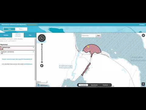
Finding fishing restrictions from the service is fairly easy. The only problem is how to decipher some of the restrictions. E.g. all the fresh waters are marked as migratory areas for fishes, although the main restrictions actually apply mainly to rapids and flow waters - AND the places where the rapids are can change due to fluctuations in the water situation.
“Restrictions can be complicated, the service itself is not”, Härkönen smiles.
“It would be nice to have different layers for different restriction types", she continues. "Since at the moment in some cases there are multiple different restrictions on top of each other. Also regarding the previous it would be good to have different default views for different users, because e.g. seine and trawl restrictions are in practice applicable only for the commercial fishing industry”, describes Härkönen.
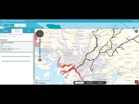
In the video above you can see multiple fishing restrictions on top of each other. Restriction information is fetched from Kaveri database and shown on the map either when the user clicks or pans in the area of the restrictions. The information shows whether or not the restriction is valid today. Service is using Suomi.fi-maps and Oskari API.
Problems arise when you try to decipher the restrictions. Can you fish or not in the Inari lake waters?
Suomi.fi-maps provides a solid background for up-to-date data
The detailed information from the various fishing restrictions are shown on an embedded map created with Suomi.fi-maps (using Oskari API). Suomi.fi-maps is an electronic service for public sector authorities in Finland.
The restriction data is updated every weekday. The information will soon also provide an overview of demanded catch measurements and close seasons that concern larger regions.
Joint effort for helping our little fishes
The Fishing restriction service development is coordinated by the Finnish Food Authority, only development is currently out sourced. The solution itself is owned by the Ministry of Agriculture and Forestry of Finland and together with the Centre of Economic Development, Transport and the Environment they are responsible for the content of the service.
Suomi.fi-maps inside the Food Athority
The Fishing restriction service is only one of the many Suomi.fi-maps based services that have been taken in use during the past few years in Finnish Food Authority. In some cases Suomi.fi-maps is used to provide the “dot on the map” and in some cases for digitizing new information. Härkönen lists some of them here, most of them need registration so the actual map-part is not visible to public:
- Sisaalis (electronic service for providing catch information in fresh water areas)
- Sähi (fish transplanting service)
- Pesä (reporting reindeer damages)
- Kalpa (service for fishing economy regions)
- EPR (animal keeper registry)
- LUOVA (organic actor monitoring service)
- ELTE (animal health and diseases)
- Support and allocation map (for e.g. finding support information for environmental compensations)